Hurricanes and tropical storms are intense forces of nature, but you can still make a difference when preparing your house to weather the storm. One of the most valuable tools at your disposal is the hurricane map, which provides up-to-date information about a storm’s path, intensity, and timing. With the right knowledge, you’ll be better equipped to handle whatever the season may bring and update your insurance to fill in the gaps for next time.
Hurricane Maps and Key Tips for Reading Them
Hurricane maps are your best friend when a storm is coming your way. They aren’t overly complicated, but those who don’t understand what these maps can and cannot predict may face unnecessary risks. Here’s what you need to know when reading a hurricane map.
Did You Know? NOAA Hurricane Center provides maps, graphics, and information about every storm heading our way.
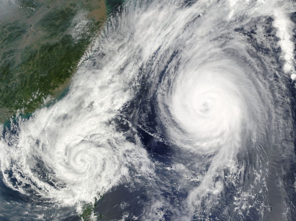
- Projected Path (Cone of Uncertainty): The hurricane’s projected path is typically represented by a line surrounded by a cone shape, known as the “cone of uncertainty.” Just like weather forecasts, experts never know precisely what the future holds. The cone you see shows the possible range where the hurricane’s center could move, sometimes also showing the percentage possibility of each path. It’s important to understand that even areas outside the centerline can experience significant effects, including strong winds and heavy rain. And, when dealing with huge, destructive storms, even a slight change in trajectory can make a massive difference.
- Storm Intensity and Category: The hurricane’s intensity is indicated by its category, which ranges from Category 1 (the weakest) to Category 5 (the strongest). A storm of a higher category poses a greater threat, but even weaker hurricanes and tropical storms can damage or flood your property.
- Timing Indicators: Along the projected path, you’ll see timing markers that show when the storm is expected to reach different locations. But before the hurricane reaches that location, the outer bands will already affect the local area. And again, while these timings are generally reliable, you can’t treat them as gospel. Early preparation that considers all possibilities is what will keep you and your home safe from the storm.
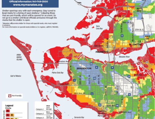
- Watches and Warnings: When looking at an online map for a lesser storm, you may see a warning or watch. A hurricane watch indicates hurricane conditions possible within the next 48 hours, while a hurricane warning indicates 36 hours.
Once you understand how to read a hurricane map, the next step is to use that information to protect your home and family. The details provided by the map are invaluable for making informed decisions about your preparations long before the rain and wind are barrelling down.
Whenever a storm comes to Florida, compare your location to the storm’s projected path, as shown on the map. If your home is within the cone of uncertainty, even on the outskirts, it’s wise to prepare as if the storm will impact your area directly. Then, use the timing indicators on the map to plan when to take specific actions.
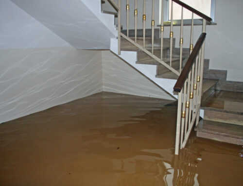
If the hurricane map shows the storm is expected to reach your area within a day or two, prioritize securing your property. This could mean boarding up windows, bringing in outdoor furniture, and using sandbags to shore up areas prone to flooding. Additionally, if the storm’s intensity suggests a power outage risk, gather enough water, non-perishable food, and other essentials to last several days.
Evacuation might be necessary if the hurricane map shows that a high-category storm is headed toward your area or a hurricane warning is issued. Some people ride out hurricanes in their homes every year without significant damage, but this isn’t something you can rely on. If experts call for evacuation, prepare your house to weather the storm and leave the area to keep your family safe.
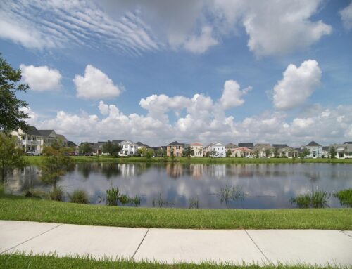
Even though it isn’t as flashy or tangible as hurricane shutters or sandbags, insurance coverage is your best protection against Florida hurricanes. However, your insurance must be sufficient to cover your home for any eventualities, lest you pay out of pocket. For example, if your home is susceptible to floods, you’ll want to double-check that your policy includes windstorms and flood coverage. Risks can vary from neighborhood to neighborhood, meaning your needs may differ depending on what specific part of your city you live in.
We’ve already had one significant storm in Florida this year. Now is the time to upgrade your insurance and confirm that your policy covers everything you need. To get the best policy at the best price, contact Anderson & Associates Insurance Group today.